
CORZ Indonesia | Research & Studies
One Development, Multiple Environmental Sources—All Transported by the Moving Ocean
Check out some other model outputs on YouTube @CORZIndonesia
Large-scale coastal developments interact with the marine environment through more than one pathway.
There may be process-water discharges.
There may be dredging.
There may be disposal of dredged material.
There may be jetty construction and other marine works.
And all of these activities occur within an ocean that changes with tides, currents, and monsoonal forcing.
Environmental assessment must therefore move beyond the simple question:
“Is material being released into the sea?”
It needs to ask:
What material is being released?
What is its source mechanism?
How does it interact with marine circulation?
Where can it be transported?
How does dispersion differ between the West and East Monsoons?
And how can numerical results support environmental-impact assessment?
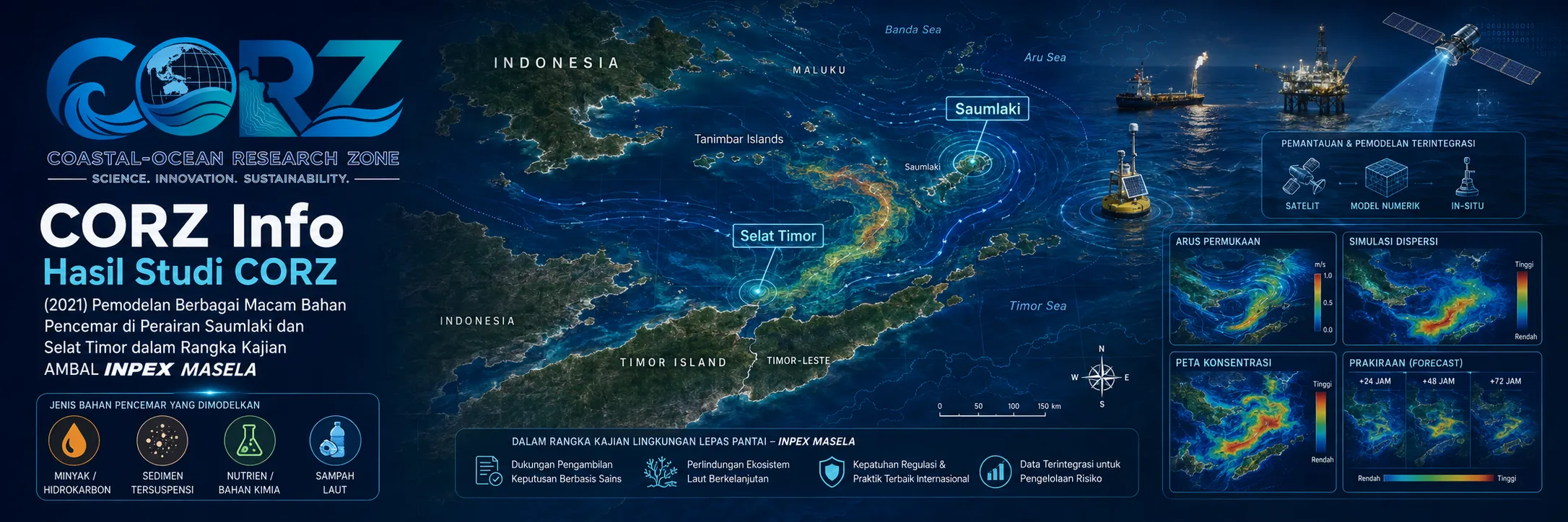
In 2021, CORZ Indonesia conducted Research & Studies involving numerical modelling of several discharge and sediment-transport scenarios in Saumlaki waters to support the INPEX Masela ANDAL assessment.
The study included six principal scenarios:
- Brine Water Dispersion — West Monsoon
• Brine Water Dispersion — East Monsoon - Sediment Dispersion from the Dumping Area — West Monsoon
• Sediment Dispersion from the Dumping Area — East Monsoon - Dredging Sediment Release at the OLNG / Pioneer Jetty — West Monsoon
• Dredging Sediment Release at the OLNG / Pioneer Jetty — East Monsoon
Together, they form an integrated framework:
SOURCE × MATERIAL × HYDRODYNAMICS × MONSOON × RECEIVING WATERS
This is the type of modelling approach required when a development interacts with the sea through multiple environmental pathways.
2021: Environmental Assessment of the Masela Development Was at a Critical Stage
The timing of the CORZ study is highly relevant.
On 9 March 2021, ANTARA reported that INPEX was undertaking three additional surveys to complete the environmental-impact documentation for the Abadi Gas Field development.
One of those activities was a metocean service visit specifically covering waves, temperature, and currents in the Tanimbar Islands region during March–April 2021.
ANTARA — INPEX conducts additional surveys for the Masela Block environmental assessment
Earlier that year, ANTARA reported SKK Migas emphasising that the Masela AMDAL process should be properly monitored, including in response to community concerns regarding possible environmental and socio-economic impacts.
These media reports were not reports about CORZ modelling results.
They provide independent historical context showing that environmental and metocean assessment was a significant component of the development process during the same period.
From Project Activity to Environmental Pathway
For a major marine development, environmental assessment needs to connect:
PROJECT ACTIVITY
to:
ENVIRONMENTAL SOURCE
then:
MARINE TRANSPORT
and finally:
THE RECEIVING ENVIRONMENT.
Conceptually:
PROJECT DESIGN
↓
SOURCE DEFINITION
↓
HYDRODYNAMIC MODEL
↓
ADVECTION / DISPERSION / SETTLING
↓
SPATIAL–TEMPORAL DISTRIBUTION
↓
ENVIRONMENTAL IMPACT INFORMATION
Numerical modelling therefore converts an engineering activity into a physical question about what may happen in the marine environment through space and time.
Three Sources, Three Different Physical Questions
The 2021 CORZ study did not treat all marine releases as a single generic pollutant.
Three different environmental-source mechanisms were distinguished.
BRINE WATER
involves the dispersion and mixing of discharged water with a salinity characteristic different from the receiving sea.
DUMPED SEDIMENT
involves sediment released during disposal within a designated dumping area.
DREDGING SEDIMENT RELEASE
involves sediment resuspended by direct disturbance of the seabed during dredging.
These processes share one ocean.
Their source mechanisms are not the same.
DIFFERENT SOURCE → DIFFERENT MODEL QUESTION.
- Brine Water Dispersion — West Monsoon
The first scenario evaluated:
BRINE WATER × WEST MONSOON.
Brine is water with relatively high dissolved-salt content compared with the surrounding receiving water.
Once discharged, the environmental question extends beyond the condition at the outfall.
The plume undergoes:
DISCHARGE → TRANSPORT → MIXING → DISPERSION → DILUTION.
Conceptually:
BRINE SOURCE
↓
MARINE DISCHARGE
↓
HYDRODYNAMIC TRANSPORT
↓
MIXING & DISPERSION
↓
SALINITY-RELATED PLUME
The West Monsoon simulation therefore provides one seasonal representation of how the marine circulation interacts with the discharge.
- Brine Water Dispersion — East Monsoon
The source remains comparable.
The seasonal hydrodynamics change.
BRINE WATER × EAST MONSOON.
The fundamental principle is:
**SAME SOURCE
- DIFFERENT SEASONAL CIRCULATION
= POTENTIALLY DIFFERENT DISPERSION.**
A single-season model cannot necessarily represent the entire range of marine conditions.
Comparing West and East Monsoons provides information on:
SEASONAL SENSITIVITY.
Hydrodynamics Is the Transport Engine
ANTARA's 2021 report specifically noted that INPEX's metocean survey included waves, temperature, and currents in the Tanimbar region.
That is physically significant.
For marine dispersion:
CURRENT IS THE TRANSPORT ENGINE.
Current direction influences advective pathways.
Current velocity contributes to transport rate.
Mixing redistributes concentrations.
Seasonal forcing can modify all of them.
Knowing only the source therefore does not tell us:
WHERE THE OCEAN MAY CARRY IT.
- Sediment Dispersion from the Dumping Area — West Monsoon
The next component evaluated sediment disposal at a designated dumping area.
Dumping does not necessarily mean:
material enters the water → material immediately remains at the seabed.
During descent, fine fractions can interact with the water column.
The pathway can include:
DUMPING SOURCE
↓
SEDIMENT RELEASE
↓
DESCENT THROUGH THE WATER COLUMN
↓
CURRENT TRANSPORT
↓
DISPERSION
↓
SETTLING
↓
DEPOSITION
Numerical modelling connects the dumping location with the surrounding area of potential influence.
- Sediment Dispersion from the Dumping Area — East Monsoon
The same type of source was then represented under East Monsoon conditions.
This is necessary because the dumping coordinates alone do not define the sediment footprint.
The footprint emerges through:
SOURCE × SEDIMENT PROPERTIES × CURRENT × TIME.
A changed circulation field can alter transport direction, dispersion, and settling patterns.
A Dumping Area Is Not an Isolated Polygon
On an engineering plan, a dumping area may be represented as a fixed polygon.
To the ocean, however, it is part of a connected moving system.
Water flows through and around it.
The environmental questions therefore include:
Where can fine released material travel?
How far may it be transported before settling?
Which receiving waters are hydrodynamically connected?
How does this relationship change with the monsoon?
Numerical modelling transforms:
A POLYGON ON A PLAN
into:
A DYNAMIC SOURCE IN A MOVING OCEAN.
- Dredging Sediment Release at the OLNG / Pioneer Jetty — West Monsoon
The third source mechanism was associated with dredging at the:
OLNG / PIONEER JETTY.
Dredging differs fundamentally from dumping.
In dredging, suspended sediment originates from disturbance of the seabed at the work location.
The pathway becomes:
DREDGING
↓
SEABED DISTURBANCE
↓
SEDIMENT RELEASE
↓
SUSPENDED-SEDIMENT PLUME
↓
HYDRODYNAMIC TRANSPORT
↓
DILUTION & SETTLING
The West Monsoon model represents plume behaviour under one seasonal hydrodynamic regime.
- Dredging Sediment Release at the OLNG / Pioneer Jetty — East Monsoon
The simulation was then evaluated under the East Monsoon.
CORZ could therefore compare:
THE SAME TYPE OF DREDGING ACTIVITY
under:
TWO DIFFERENT MARINE CONDITIONS.
Questions can then be structured around differences in:
plume direction • potential area of influence • dilution pattern • transport pathway • settling behaviour.
The model—not assumption—should provide the answer.
Marine Infrastructure Was a Central Part of the Masela Development Concept
Public consultation on the Masela environmental assessment described a development concept involving subsea wells, offshore production facilities, a subsea gas pipeline, an onshore LNG plant, and an LNG loading jetty/terminal.
ANTARA — Public consultation and environmental assessment for the Abadi LNG development in Saumlaki
In June 2021, ANTARA also reported an official visit to the planned LNG-port location near Saumlaki as part of preparations for the national strategic project.
These reports do not establish that the specific Pioneer Jetty represented in the CORZ model is identical to a facility described by the media.
They provide contextual evidence that marine and coastal infrastructure formed an important component of the overall project.
Dredging Source and Dumping Source Should Not Be Confused
The distinction is fundamental.
DREDGING SOURCE
results from disturbance of sediment at the excavation site.
DUMPING SOURCE
results from placement or release of dredged material at another designated area.
Their:
source geometry • location • release mechanism • duration • sediment behaviour
can differ.
Therefore, treating them as separate modelling scenarios provides a more defensible environmental assessment.
Six Scenarios—Not One Generic Plume
The overall study can be expressed as:
| Environmental Source | West Monsoon | East Monsoon |
| Brine Water | Scenario 1 | Scenario 2 |
| Sediment Dumping | Scenario 3 | Scenario 4 |
| Dredging Release — OLNG/Pioneer Jetty | Scenario 5 | Scenario 6 |
Thus:
3 SOURCES × 2 MONSOONS = 6 SCENARIOS.
This is one of the strongest features of the CORZ study.
The objective is not simply:
“model a plume.”
It is:
separate the source mechanisms, compare seasonal forcing, and understand each environmental pathway independently.
From Source to Receptor
A marine environmental model becomes increasingly useful when it moves from:
SOURCE
to:
TRANSPORT
to:
DISPERSION
and eventually to:
RECEPTOR.
Potential receptors may include:
coastal waters • fisheries grounds • mangrove systems • coral environments • navigation waters • community coastlines • marine facilities • intake locations
Each receptor can have a different level and type of sensitivity.
Numerical results can therefore provide one physical layer within a broader environmental-impact assessment.
Saumlaki Is More Than a Project Location
In June 2021, ANTARA reported government efforts to optimise the Integrated Marine and Fisheries Centre in Saumlaki to strengthen local economic activity and fisheries.
ANTARA — Optimising Saumlaki's integrated marine and fisheries centre
This context matters.
The surrounding sea supports more than energy infrastructure.
It also supports:
FISHERIES • COASTAL LIVELIHOODS • NAVIGATION • ECOSYSTEMS • LOCAL ECONOMIC ACTIVITY.
Environmental assessment therefore operates at the intersection of:
DEVELOPMENT
and:
ENVIRONMENTAL PROTECTION.
Numerical Modelling Does Not Replace ANDAL—It Strengthens the Physical Analysis
A model is not an ANDAL document by itself.
It is a scientific tool capable of supporting particular environmental questions.
For example:
Where can a plume develop?
How does monsoon forcing change the transport pathway?
How does dumping differ from dredging?
Where should monitoring be prioritised?
Which scenarios require closer assessment?
Model results can then be integrated with:
FIELD OBSERVATION + WATER QUALITY + ECOLOGY + SOCIAL INFORMATION + ENGINEERING DESIGN + REGULATORY CRITERIA
to support a more complete environmental assessment.
From Dispersion Modelling to Monitoring Design
One of the most practical applications of modelling is more targeted environmental monitoring.
Without a model:
monitor mainly near the source.
With a model:
monitor along plausible transport pathways.
The workflow becomes:
SOURCE
↓
MODELLED TRANSPORT PATHWAY
↓
POTENTIAL EXPOSURE AREA
↓
MONITORING LOCATIONS
↓
FIELD VERIFICATION
Numerical modelling therefore does not eliminate the need for field measurement.
It helps determine:
where field measurement may provide the greatest value.
Multi-Source Pollution Requires Multi-Scenario Modelling.
Brine water is not sediment.
Dumped sediment is not the same source as dredging-induced suspended sediment.
The West Monsoon is not the East Monsoon.
Treating all of them as one condition would remove important physical distinctions.
The 2021 Saumlaki study reflects the CORZ Indonesia Research & Studies approach:
Define Every Source.
Understand the Hydrodynamics.
Separate the Processes.
Compare the Monsoons.
Model the Dispersion.
Identify the Receiving Waters.
Support Better Environmental Decisions.
Because the correct question is not simply:
“Will something be discharged into the sea?”
It is:
“What is being released, when is it released, and where can the ocean carry it?”
CORZ Indonesia for Research & Studies
Hydrodynamic Modelling • Brine Dispersion Modelling • Sediment Transport • Dredging Plume Modelling • Dumping-Area Assessment • ANDAL/AMDAL Modelling Support • Marine Environmental Assessment
Coastal-Ocean Research Zone (CORZ) Indonesia provides research, modelling, analysis, and technical solutions for coastal and ocean environments.
YouTube: https://www.youtube.com/@CORZIndonesia
Website: https://corz.co.id
Email: info@corz.co.id
© 2026 CORZ Indonesia. All Rights Reserved.


