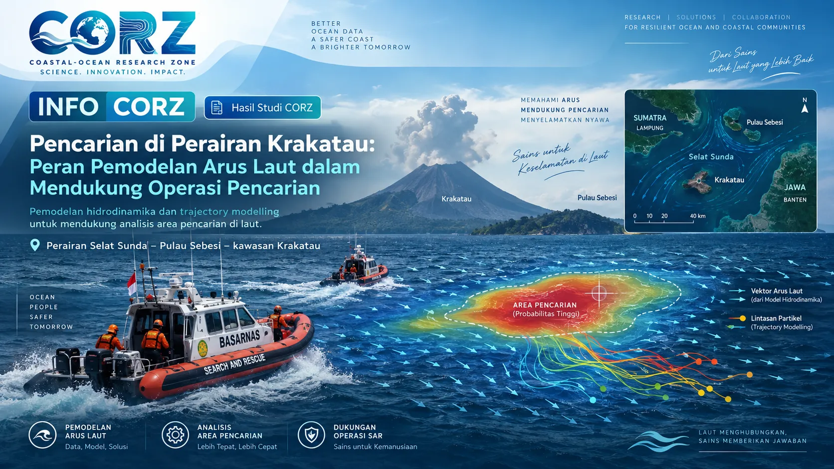
Location: Sunda Strait – Sebesi Island – Krakatau Waters
Search operations at sea are a race against time, an expanding search area, and continuously changing ocean conditions. This challenge can be seen in the search for a group consisting of five journalists and three speedboat crew members who were reported to have lost contact while travelling in the Sunda Strait area.
Search and rescue teams conducted sweeping operations from Sebesi Island toward the Krakatau area, including waters surrounding the Krakatau islands.
Main news:
ANTARA — Tim SAR Sisir Perairan Krakatau Cari Jurnalis yang Hilang Kontak
https://www.antaranews.com/berita/5733409/tim-sar-sisir-perairan-krakatau-cari-jurnalis-yang-hilang-kontak
The development of the search operation demonstrates the practical importance of oceanographic information in Search and Rescue activities. Search areas may need to be adjusted by considering ocean-current direction, wave-induced displacement, wind conditions, and the time elapsed since the last known position.
The Sunda Strait presents a particularly complex environment. It connects major water masses, contains numerous islands, has highly variable seabed topography, and experiences currents that change with tides, wind forcing, and regional oceanographic conditions.
Consequently, a drifting person or floating object may not simply move along a straight line from its last known position.
In situations such as these, hydrodynamic modelling combined with trajectory modelling can serve as a valuable scientific decision-support tool. CORZ can develop current fields at suitable spatial and temporal resolutions, after which an ensemble of virtual particles can be released from a defined last known position.
Each particle can be assigned slightly different initial positions, release times, wind-response parameters, or drift characteristics. Instead of generating a single deterministic track, the simulations can therefore create a range of possible pathways that collectively form a search probability area.
The model can also be updated when new information becomes available—for example, revised last-contact times, debris sightings, communication signals, vessel observations, updated wind conditions, or wave forecasts.
Through such updates, trajectory modelling becomes a dynamic decision-support tool, while operational decisions remain under the authority of the official Search and Rescue agencies responsible for the mission.
Another useful application is backtracking. If debris or an object potentially associated with a missing vessel is found at a certain location, the model can be run backward in time to estimate possible source regions.
Combining forward tracking and backtracking can help narrow the range of plausible movement scenarios when field information remains limited.
The Krakatau case clearly illustrates that modern search operations are not determined only by the number of vessels, drones, or sensors available. Ocean currents, wind, waves, and time collectively determine how the search area evolves.
When these factors are integrated through numerical modelling, environmental data can be transformed into more operational spatial information that may support search planning—while remaining complementary to the expertise, observations, procedures, and official decisions of Search and Rescue authorities.
Supporting news:
Liputan6 — SAR Perluas Pencarian 5 Jurnalis Hilang Kontak ke Utara Anak Krakatau
https://www.liputan6.com/news/read/8288370/sar-perluas-pencarian-5-jurnalis-hilang-kontak-ke-utara-anak-krakatau-besok
Related operational-condition news:
iNews — SAR Terus Cari 5 Jurnalis Hilang di Selat Sunda, Gelombang 4 Meter Jadi Tantangan
CORZ Indonesia — Ocean Science for Safer Seas.