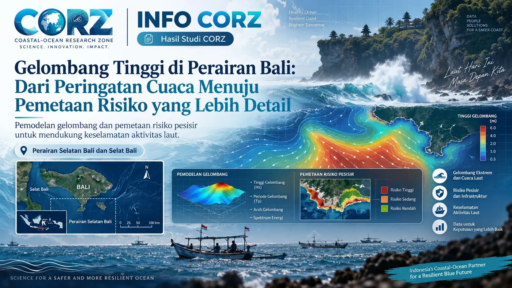
Location: Southern Bali Waters and the Southern Bali Strait
High-wave warnings provide essential information for fishermen, vessel operators, marine tourism activities, ports, and coastal communities. On 10 September 2026, BMKG, as reported by IDN Times Bali, warned of waves reaching approximately 2.5–4 metres during the 10–13 September period in the southern Bali Strait, southern Bali waters, and the southern Lombok Strait. Such conditions can have direct implications for maritime safety, particularly for smaller vessels.
Main news:
IDN Times Bali — BMKG Denpasar Peringatkan Gelombang 4 Meter di Perairan Bali
https://bali.idntimes.com/news/bali/bmkg-denpasar-peringatkan-gelombang-4-meter-di-perairan-bali-00-r544s-syzrlc
Regional marine forecasts provide an essential basis for safety awareness. However, when an assessment needs to focus on a more local scale—such as a specific beach, tourism area, harbour, navigation route, or erosion-prone coastline—regional wave-height information alone may not provide sufficient spatial detail.
As waves propagate toward the coast, they undergo several physical transformations, including shoaling, refraction, diffraction, and wave breaking, largely controlled by water depth, bathymetry, seabed configuration, and coastline geometry. As a result, two coastal locations situated relatively close to each other may experience significantly different levels of wave exposure.
This is where CORZ Indonesia’s spectral wave modelling capabilities can provide an additional layer of detailed information. Wind data, offshore wave conditions, bathymetry, and coastline geometry can be integrated to simulate how wave energy propagates from deeper waters toward the coast.
The model outputs may include maps of significant wave height, mean wave direction, wave period, wave power, and wave-breaking zones, with spatial resolution adjusted to the specific objectives of the study.
These outputs can then be translated into coastal exposure and risk maps. Shorelines, marine routes, or infrastructure exposed to relatively high wave energy can be distinguished from areas that are more sheltered. By modelling several combinations of wind and wave conditions, changes in risk patterns can also be assessed under normal conditions, seasonal conditions, and high-wave events.
This approach is not intended to replace official marine-weather warnings issued by BMKG. Instead, higher-resolution numerical modelling can function as a form of technical downscaling, helping translate regional ocean conditions into more site-specific information for particular coastal areas.
Its applications may support fishing safety, port operations, marine tourism, coastal engineering, shoreline management, and erosion–accretion studies.
By integrating marine-weather forecasts with local-scale numerical modelling, information such as “waves of 2.5–4 metres” can be developed into more operational questions:
Which coastal sectors receive the greatest wave energy? When are the most critical conditions expected? From which direction do the dominant waves arrive? Which marine and coastal activities are most exposed?
This is where ocean science and numerical modelling can help transform regional warnings into spatial information that is more directly useful for planning, risk assessment, and decision-making.
Related news:
BaliPost — Waspada, Gelombang hingga 4 Meter Ancam Perairan Bali
https://www.balipost.com/news/2026/08/31/577962/Waspada%2CGelombang-hingga-4-Meter...html
CORZ Indonesia — From Ocean Data to Coastal Solutions.