Marine conditions can change rapidly, while different maritime activities have different levels of vulnerability. Conditions that remain manageable for a large vessel, for example, may be hazardous for small fishing boats or coastal tourism activities.
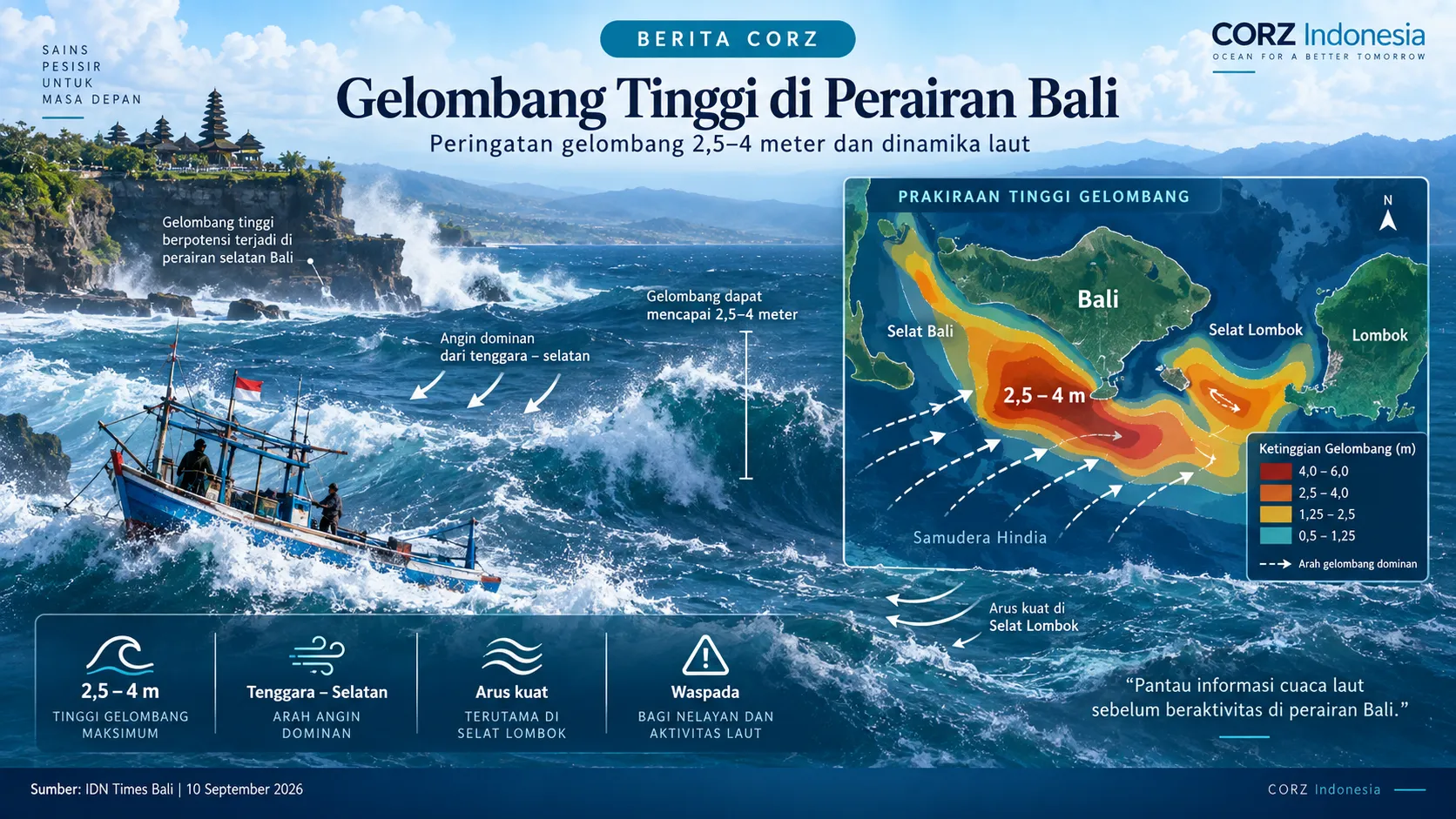
On 10 September 2026, IDN Times Bali reported a BMKG warning regarding potential wave heights of 2.5–4 metres between 10 and 13 September 2026 in the southern Bali Strait, waters south of Bali, and the southern Lombok Strait. The report also highlighted relatively strong winds and currents in several waters surrounding Bali and Lombok.
Read the IDN Times Bali article: BMKG Denpasar Peringatkan Gelombang 4 Meter di Perairan Bali
How can CORZ contribute?
Marine warnings are essential for maritime safety. For more detailed planning purposes, however, regional information can be further developed using spectral wave and hydrodynamic modelling.
CORZ Indonesia can simulate the spatial distribution of wave height, wave direction, wave period, and wave energy at resolutions suited to specific study requirements. In straits, bays, ports, or selected coastal areas, modelling can be refined to understand how offshore wave conditions transform as they approach the coast.
The same approach can be used to compare seasonal conditions or multiple marine-weather scenarios. Such information can support planning for local navigation, fishing activities, port facilities, coastal infrastructure, and marine tourism.
Numerical modelling is not intended to replace official BMKG warnings. Instead, it can provide an additional analytical layer that translates regional ocean conditions into more site-specific technical information.
CORZ Indonesia supports wave and hydrodynamic studies to improve understanding of marine conditions and provide a stronger technical basis for coastal and ocean planning.