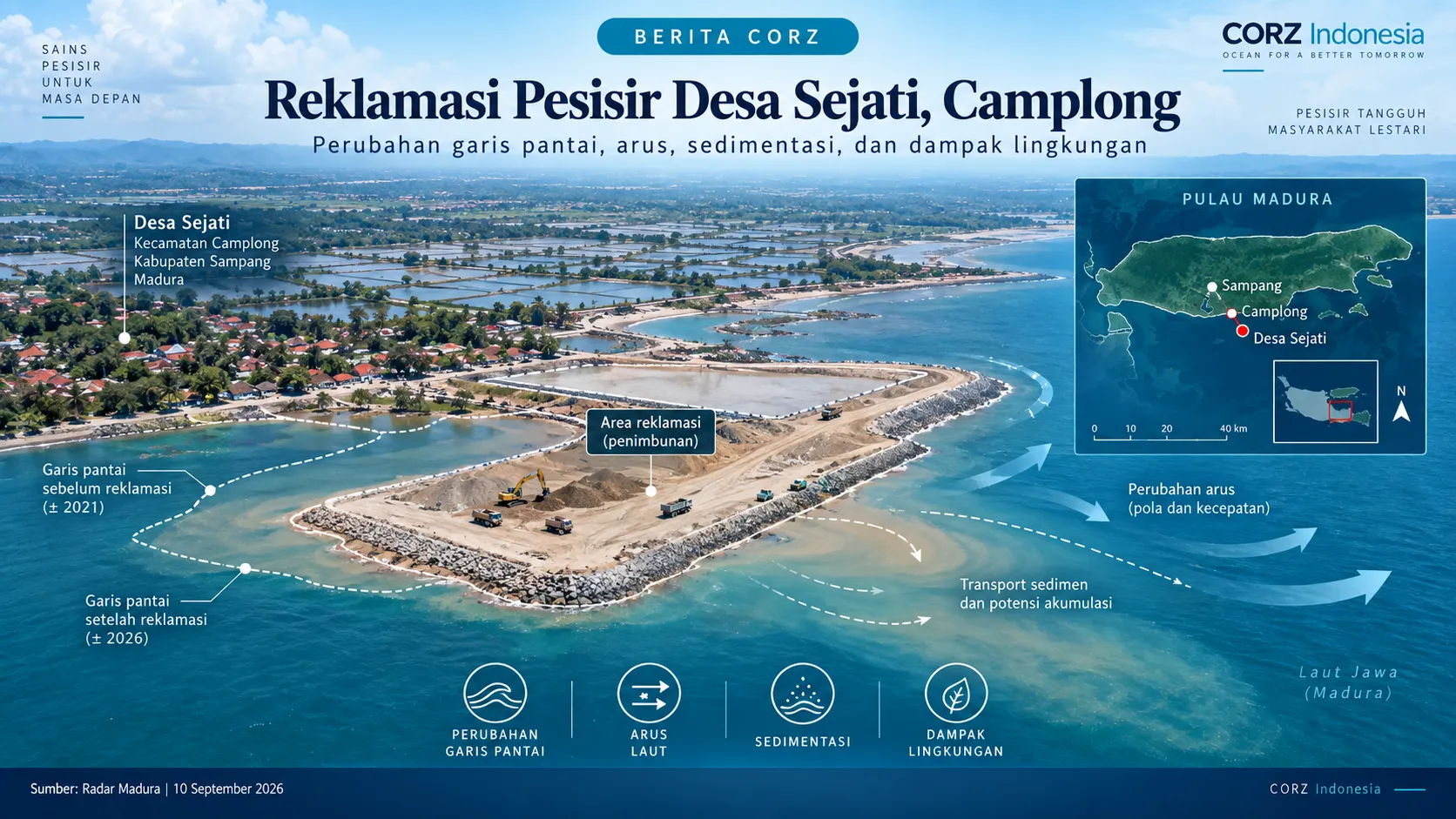
Coastal reclamation does more than increase the amount of land available along the shoreline. Any change in coastal geometry can potentially alter currents, wave propagation, sediment movement, and water circulation in the surrounding area.
Radar Madura reported on 10 September 2026 that reclamation activities were taking place at several locations along the coast of Camplong District, Sampang Regency. One of the reported sites is located in Desa Sejati, where reclamation activities were said to occur within or near the coastal setback area. Parts of the reclaimed land were also reported as potentially being used for shrimp ponds.
The issue has attracted attention from the Sampang Regency Regional House of Representatives because of concerns regarding possible environmental impacts if reclamation activities continue without sufficient assessment.
Read the Radar Madura article: Reklamasi Pesisir Sejati Diduga Jadi Tambak Udang
How can CORZ contribute?
For reclamation projects, one of the most important technical questions is how coastal conditions may change compared with the situation before reclamation.
CORZ Indonesia can support this type of assessment by integrating field data, satellite imagery, shoreline-change analysis, and numerical modelling to compare pre-reclamation and post-reclamation conditions.
Hydrodynamic and wave modelling can help identify potential changes in current patterns, wave conditions, sedimentation, and erosion–accretion processes. Where reclamation supports aquaculture or other coastal activities, the analysis can also be expanded to examine water circulation, flushing, and relevant water-quality considerations.
Different reclamation layouts or development scenarios can also be compared before construction. This can help identify configurations that may create low-current zones, promote sediment accumulation, redirect sediment transport, or affect adjacent shoreline areas.
Such technical studies do not replace legal, permitting, or regulatory processes. However, scientific analysis and numerical modelling can provide a more objective technical basis for understanding the physical consequences of modifying a coastline.