Major floods do not only leave impacts on land. Sediment carried downstream by rivers can reach estuaries, where it interacts with tides, coastal currents, and ocean waves. These processes may alter the shape of river mouths, create new sediment deposits, and influence sediment transport along the coastline.
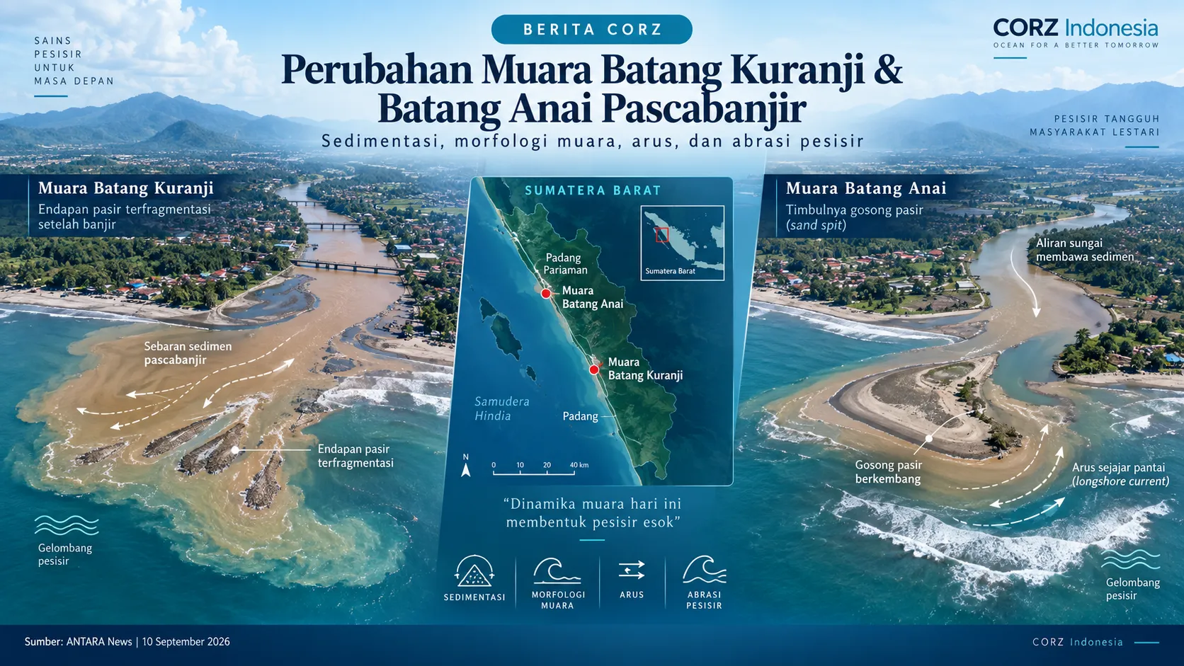
ANTARA News reported on 10 September 2026 that the Batang Kuranji Estuary in Padang City and the Batang Anai Estuary in Padang Pariaman Regency showed different morphological responses after the major flooding of November 2025. Although both estuaries received large amounts of sediment, their subsequent development differed. At Batang Kuranji, some sediment deposits were fragmented by wave action while natural flushing remained active. At Batang Anai, meanwhile, a sand spit developed and may influence coastal currents and sedimentation around the estuary.
These changes are important because the evolution of estuarine morphology may eventually contribute to sedimentation, navigation constraints, or coastal erosion if the processes continue over time.
Read the ANTARA News article: Akademisi Unand Temukan Perbedaan Muara Dua Sungai Usai Dilanda Banjir
How can CORZ contribute?
Problems of this kind require an understanding of the interaction between river discharge, tides, ocean currents, waves, and sediment transport. CORZ Indonesia has relevant capabilities in hydrodynamic, wave, sediment transport, and coastal morphology modelling that can support such assessments.
Numerical modelling can be used to examine how sediment moves from rivers into coastal waters, where deposition is likely to occur, how waves reshape sediment deposits near the river mouth, and how these processes may change under different seasonal and river-flow conditions.
Where necessary, several management options—such as local dredging, river-mouth channel management, or modifications to coastal structures—can be tested through alternative modelling scenarios before physical interventions are implemented.
This approach helps decision-makers move beyond a single snapshot of present conditions and develop a broader understanding of the evolving river–estuary–coastal system.
CORZ Indonesia supports the use of coastal and marine modelling as a scientific decision-support tool for developing site-specific and better-informed estuary management strategies.