
CORZ Indonesia | Research & Studies
The Beauty of the Sea Is What Visitors See. Its Dynamics Are What We Need to Understand.
Check out some other model outputs on YouTube @CORZIndonesia
Labuan Bajo is internationally recognised for its island landscapes, clear tropical waters, coral reefs, diving, snorkeling, sailing trips, liveaboards, and access to Komodo National Park.
Behind that spectacular scenery, however, lies a continuously changing physical ocean.
Currents accelerate, weaken and change direction.
Waves grow and propagate.
Sea-surface temperature develops spatial patterns.
Salinity changes with water-mass characteristics and mixing.
For a visitor, the ocean may appear to be the scenery.
For oceanography, it is:
A DYNAMIC PHYSICAL SYSTEM.
Sustainable and safe marine tourism therefore benefits from understanding not only:
where tourism destinations are located,
but also:
how the surrounding ocean behaves.
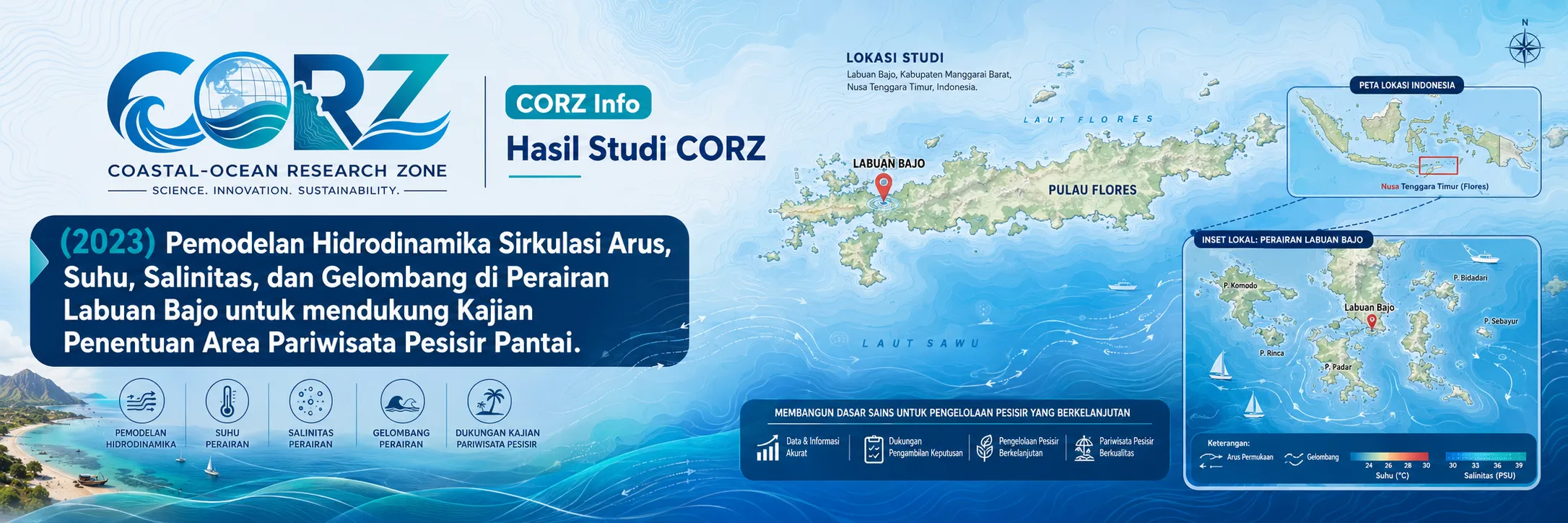
In 2023, CORZ Indonesia conducted Research & Studies involving integrated modelling of marine conditions in Labuan Bajo waters to support tourism-related ocean understanding.
The studies included:
- Hydrodynamics + Sea Surface Salinity
- Hydrodynamics + Sea Surface Temperature
- Hydrodynamics + Significant Wave Height
Together, they establish a multi-parameter framework:
CURRENT × TEMPERATURE × SALINITY × WAVES × SPACE × TIME.
The ocean is no longer treated merely as the backdrop to tourism.
It becomes part of:
THE TOURISM ENVIRONMENT ITSELF.
2023: The Year Labuan Bajo Took the International Stage
The timing of the CORZ study was particularly significant.
Labuan Bajo hosted the 42nd ASEAN Summit on 9–11 May 2023, bringing regional leaders and international attention to the destination. Extensive preparations were made across infrastructure, health services, accommodation, and supporting facilities.
ANTARA — Labuan Bajo prepares for the 42nd ASEAN Summit
Following the summit, the Labuan Bajo Flores Tourism Authority described the event as creating a new benchmark for tourism development and service quality in the destination.
By the end of 2023, 423,847 visitors had travelled to Labuan Bajo and West Manggarai, far exceeding the year's target.
This creates a straightforward relationship:
TOURISM GROWTH → MORE MARINE ACTIVITY → GREATER VALUE OF OCEAN INFORMATION.
Marine Tourism Is Central to the Labuan Bajo Experience
Many of Labuan Bajo's signature experiences take place on or beneath the sea.
Visitors depend on:
tour boats • phinisi vessels • speedboats • diving boats • snorkeling boats
to reach the surrounding islands.
Local authorities reported approximately 52 diving locations around Labuan Bajo and its small islands in 2023.
By 10 November 2023, some 23,601 visitors had participated in diving and snorkeling activities.
The implication is clear:
THE OCEAN IS NOT SEPARATE FROM THE TOURISM PRODUCT.
THE OCEAN IS THE TOURISM PRODUCT.
- Hydrodynamics + Sea Surface Salinity
The first CORZ modelling component combines:
CURRENT CIRCULATION
with:
SEA SURFACE SALINITY — SSS.
Salinity represents the concentration of dissolved salts in seawater.
In physical oceanography, however, it is also an important indicator of water-mass characteristics.
Spatial salinity variations can be influenced by:
oceanic water masses • freshwater input • rainfall • evaporation • mixing • circulation.
When salinity is examined together with currents:
SALINITY
describes characteristics of the water,
while:
CURRENT CIRCULATION
describes how the water moves.
Together:
WATER-MASS CHARACTERISTICS + MOVEMENT
provide a more complete description of the marine environment.
Why Does Salinity Matter for Marine Tourism?
Visitors rarely choose a destination based on a salinity value.
That does not make salinity unimportant.
It forms part of the physical marine environment relevant to broader assessments of:
water masses • coral environments • ecosystem conditions • coastal water quality • marine environmental monitoring.
Scientifically, however:
A SALINITY MAP IS NOT AUTOMATICALLY A TOURISM-SUITABILITY MAP.
Its value increases when interpreted together with currents, temperature, waves, ecology, and operational information.
- Hydrodynamics + Sea Surface Temperature
The second component combines:
CURRENT CIRCULATION
with:
SEA SURFACE TEMPERATURE — SST.
A single thermometer provides a temperature at one location.
A numerical model provides a:
TEMPERATURE FIELD.
Adding currents connects:
WHAT THE THERMAL CONDITION IS
with:
HOW THE WATER IS MOVING.
This creates a more physically meaningful view of the upper ocean.
Sea Temperature and the Visitor Experience
Sea temperature forms part of the physical conditions experienced during:
diving • snorkeling • swimming • other water-based activities.
Its scientific importance is broader still.
SST is related to:
ocean–atmosphere interaction • water-mass characteristics • marine ecosystems • coral environments • environmental monitoring.
In April 2023, BMKG noted that relatively warm sea-surface conditions around East Nusa Tenggara, together with atmospheric disturbances and wind convergence, were helping create weather conditions requiring caution by tourism vessels in Labuan Bajo.
This illustrates the wider relationship:
THE OCEAN SURFACE AND THE ATMOSPHERE ABOVE IT ARE CONNECTED.
- Hydrodynamics + Significant Wave Height
The third modelling component has perhaps the most immediately visible connection with marine tourism:
CURRENT CIRCULATION + SIGNIFICANT WAVE HEIGHT.
Significant Wave Height (Hs) is one of the standard parameters used to describe sea state.
In general terms, it statistically represents the average height of roughly the highest one-third of waves in a wave record.
For marine activities:
CURRENTS
describe moving water,
while:
WAVES
describe the energetic condition of the sea surface.
Together, they contribute to:
MARINE SITUATIONAL AWARENESS.
Real Events in 2023 Demonstrated Why Wave Information Matters
In January 2023, a tourism vessel sank in the Batu Tiga waters of Labuan Bajo after reportedly being struck by waves.
In May, another tourism vessel carrying passengers from Komodo Island toward Labuan Bajo sank after encountering strong wind and high waves.
detikBali — Tourism vessel sinks after encountering wind and high waves near Labuan Bajo
These incidents were not results of the CORZ modelling and are not presented as model validation.
They provide independent real-world context for a simple principle:
MARINE TOURISM DEPENDS ON MARINE CONDITIONS.
Currents Matter Even When the Surface Appears Calm
In December 2023, the Labuan Bajo Flores Tourism Authority warned visitors and operators to remain alert to weather and marine conditions.
The authority specifically noted strong-current locations including Taka Makassar and Padar Island, while other areas around Komodo and Rinca can experience significant wave conditions.
ANTARA — Labuan Bajo tourism authority warns visitors about weather and strong marine conditions
This is particularly relevant to hydrodynamic modelling.
Currents are often less visually obvious than waves.
Yet they can strongly influence:
small vessels • swimmers • snorkelers • divers • floating objects • marine operations.
A Current Field Is an Invisible Map of the Moving Sea
Hydrodynamic models represent current circulation through vectors.
Each vector contains:
DIRECTION × VELOCITY × LOCATION × TIME.
A single vector is only one piece of information.
Thousands of vectors evolving through time create:
A DYNAMIC MAP OF THE SEA.
This allows the analysis to examine:
where currents differ,
where the water is moving,
how circulation changes with time,
and:
how different marine areas are physically connected.
The Destination Is Fixed. The Ocean State Is Not.
Padar Island remains in the same location.
Taka Makassar remains in the same location.
Manta Point remains on the map.
But:
THE OCEAN AROUND THEM CHANGES.
Currents change.
Winds change.
Waves change.
Temperature patterns change.
Therefore:
A STATIC TOURISM MAP
cannot fully describe:
A DYNAMIC MARINE DESTINATION.
From Destination Maps to Marine Tourism Intelligence
A conventional tourism map asks:
Where should visitors go?
Ocean modelling adds:
What is the sea doing there?
A future marine-tourism information framework could combine:
DESTINATION
CURRENT
WAVE
SST
SALINITY
WEATHER
↓
MARINE TOURISM INTELLIGENCE.
Such information does not replace the official forecasts of meteorological and maritime authorities.
It provides an additional oceanographic analysis layer.
Tourism Promotion Must Be Matched by Tourism Safety
A world-class marine destination needs beautiful scenery.
It also needs safe operations.
In March 2023, adverse weather prompted Labuan Bajo port authorities to temporarily prohibit tourism vessels from sailing in Labuan Bajo and Komodo National Park waters.
detikTravel — Tourism vessels temporarily prohibited from sailing during bad weather in Labuan Bajo
Operational sailing decisions remain the responsibility of authorised agencies and vessel operators.
CORZ modelling does not replace those authorities.
Its contribution is to strengthen:
UNDERSTANDING OF THE PHYSICAL MARINE ENVIRONMENT.
Four Parameters, Four Views of the Same Ocean
The study can be summarised simply.
CURRENT
asks:
How is the water moving?
SEA SURFACE TEMPERATURE
asks:
What is the thermal state of the surface ocean?
SEA SURFACE SALINITY
asks:
What are the salinity characteristics of the surface water?
SIGNIFICANT WAVE HEIGHT
asks:
What is the sea-state condition?
Integrate them and we obtain:
HOW THE WATER MOVES
WHAT THE WATER IS LIKE
HOW THE SURFACE BEHAVES
↓
A MORE COMPLETE MARINE ENVIRONMENT PICTURE.
From Ocean Modelling to Tourism Decision Support
Studies of this type can provide a physical-information foundation for:
- Marine Tourism Planning
• Diving & Snorkeling Environmental Assessment
• Tourism-Vessel Route Analysis
• Sea-State Assessment
• Marine Safety Studies
• Coastal and Marine Environmental Monitoring
• Search & Rescue Support
• Destination Environmental Management
• Marine Spatial Planning
• Ocean and Climate Information for Tourism
The appropriate workflow is:
OCEAN DATA
↓
NUMERICAL MODELLING
↓
CURRENT + SST + SSS + WAVES
↓
MARINE ENVIRONMENT INFORMATION
↓
INTEGRATION WITH OFFICIAL FORECASTS & FIELD INFORMATION
↓
BETTER-INFORMED TOURISM DECISIONS.
Beautiful Destinations Need Ocean Intelligence.
Labuan Bajo has become a world-class destination.
In 2023, it hosted ASEAN leaders.
Hundreds of thousands of visitors arrived.
Tens of thousands entered the sea to dive and snorkel.
Tourism vessels continuously connected its islands.
As marine activity grows:
THE VALUE OF UNDERSTANDING THE OCEAN GROWS WITH IT.
The 2023 Labuan Bajo study reflects the CORZ Indonesia Research & Studies approach:
Model the Currents.
Map the Temperature.
Understand the Salinity.
Simulate the Waves.
Follow Their Changes through Space and Time.
Translate Ocean Dynamics into Tourism Intelligence.
Support Safer and Better Marine Experiences.
Because a marine destination should not ask only:
“Where is the beautiful place?”
It should also ask:
“What is the ocean doing around it?”
CORZ Indonesia for Research & Studies
Hydrodynamic Modelling • Current Circulation • Sea Surface Temperature • Sea Surface Salinity • Significant Wave Modelling • Marine Tourism • Coastal-Ocean Environmental Intelligence
Coastal-Ocean Research Zone (CORZ) Indonesia provides research, modelling, analysis, and technical solutions for coastal and ocean environments.
YouTube — CORZ Indonesia
Website — CORZ Indonesia
Email: info@corz.co.id
© 2026 CORZ Indonesia. All Rights Reserved.


