
CORZ Indonesia | Research & Studies
Understanding the Ocean Before Allocating Coastal Space
Check out some other model outputs on YouTube @CORZIndonesia
Coastal space is not an empty surface that can be planned simply by drawing boundaries on a map.
Behind every coastline lies a continuously moving marine system. Waves transport energy toward the shore. Currents move water masses between different locations. Both can change significantly with the monsoon.
Coastal spatial planning therefore needs to ask more than:
“Where is space available?”
It should also ask:
How energetic are the waters? Where do the currents flow? How does wave exposure vary along the coast? Do West and East Monsoon conditions produce the same marine environment? And which coastal uses are most compatible with those physical characteristics?
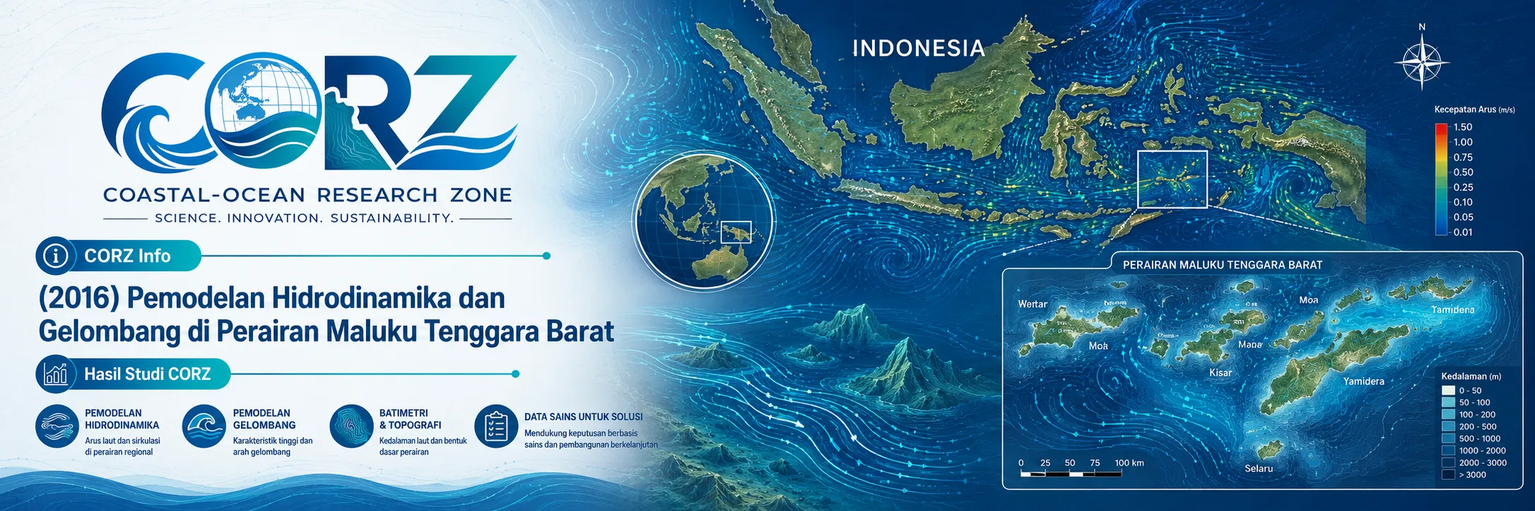
In 2016, CORZ Indonesia conducted Research & Studies involving integrated hydrodynamic and wave modelling in the waters of Southwest Maluku Regency, supporting coastal spatial-planning assessment.
Four principal modelling components were undertaken:
Wave Modelling — West Monsoon
Wave Modelling — East Monsoon
Current-Circulation Modelling — West Monsoon
Current-Circulation Modelling — East Monsoon
Together, they create an integrated framework:
WAVES × CURRENTS × SEASON × COASTAL SPACE
Coastal Planning Requires an Understanding of the Marine System
The planning context was already well established. Southwest Maluku Regency had formally adopted a 2013–2033 Strategic Plan for Coastal Areas and Small Islands, recognising coastal space as the transition between terrestrial and marine ecosystems influenced by processes occurring on both sides of the shoreline.
This is precisely where ocean modelling contributes value.
A planning map identifies where a coastal zone is located.
Numerical modelling helps explain how that zone physically functions.
Both dimensions are needed for a more informed approach to coastal management.
West Monsoon Waves: Mapping Energy across the Coastal Zone
The first component modelled the West Monsoon wave environment.
Waves are one of the principal mechanisms transporting energy toward coastlines. Their characteristics can influence navigation, ports, coastal infrastructure, aquaculture, fisheries, shoreline stability, and exposure of marine activities.
Numerical wave modelling transforms point information into a spatial wave field.
Conceptually:
WIND → WAVE GENERATION → PROPAGATION → TRANSFORMATION → COASTAL EXPOSURE
The resulting simulations provide a framework for examining significant spatial differences in wave conditions, propagation pathways, and relative exposure among different parts of the coastline.
East Monsoon Waves: Same Coastline, Different Seasonal Forcing
The wave model was then evaluated under East Monsoon conditions.
This comparison matters because Indonesia's monsoonal climate changes atmospheric forcing and consequently the marine wave environment.
The principle is:
SAME COASTLINE + DIFFERENT MONSOON = DIFFERENT WAVE ENVIRONMENT
An area that is relatively sheltered under one seasonal regime may not exhibit exactly the same characteristics during another.
Coastal planning based on only one seasonal condition can therefore provide an incomplete representation of marine exposure.
West Monsoon Currents: Understanding Marine Connectivity
The third component modelled current circulation during the West Monsoon.
Current vectors describe more than water velocity.
Each carries:
DIRECTION + VELOCITY + LOCATION + TIME
Together, they show how different parts of the marine environment are physically connected.
This information is relevant to spatial planning for aquaculture, ports, marine outfalls and intakes, conservation areas, navigation, potential pollutant transport, suspended-material movement, and other coastal activities.
A useful distinction is:
Waves describe the energy reaching a location. Currents describe how that location is connected to the surrounding sea.
East Monsoon Currents: When the Pathways Change
The current-circulation model was also run for the East Monsoon.
This allows:
WEST MONSOON CIRCULATION
to be compared with:
EAST MONSOON CIRCULATION.
For planners, this comparison is important because geographical space remains fixed while its oceanographic behaviour may change throughout the year.
The same coastal location may interact with different water-mass pathways under different seasonal conditions.
Four Models, One More Complete Coastal Picture
The four modelling components form an integrated physical description:
WAVE — WEST MONSOON
WAVE — EAST MONSOON
CURRENT — WEST MONSOON
CURRENT — EAST MONSOON
Combined, they characterise:
ENERGY + TRANSPORT + SEASONALITY + LOCATION
This is what moves numerical modelling beyond oceanographic description and toward coastal spatial intelligence.
2016: A Strategic Year for Regional Development
The study also took place during a significant period for regional development.
On 23 March 2016, President Joko Widodo decided that the Masela LNG development would follow an onshore scheme, with regional development and local economic benefits among the government's considerations.
ANTARA — President decides Masela development will be onshore, 23 March 2016
The Jakarta Post — Masela saga ends as Jokowi announces onshore scheme
Marine connectivity infrastructure was also receiving attention. Indonesia's Ministry of Transportation formally adopted the Saumlaki Port Master Plan in March 2016, while two ports in Southwest Maluku were among the new port facilities inaugurated in Maluku later that year.
These developments were not reports about the CORZ modelling study. Their relevance is contextual: they illustrate why coastal and marine space in the region was becoming increasingly important for infrastructure, energy, fisheries, transportation, and regional development.
From Ocean Modelling to Coastal Spatial Intelligence
At CORZ Indonesia, the objective is not merely to produce wave-height maps or current-vector animations.
The greater objective is to translate marine dynamics into spatially useful information for planning and decision-making.
The workflow can be expressed as:
OCEANOGRAPHIC DATA
↓
HYDRODYNAMIC MODELLING + WAVE MODELLING
↓
WEST & EAST MONSOON SCENARIOS
↓
SPATIAL MARINE CHARACTERISTICS
↓
COASTAL SUITABILITY INFORMATION
↓
COASTAL SPATIAL PLANNING
This approach can support marine spatial planning, coastal zoning, ports, aquaculture, marine tourism, conservation, coastal infrastructure, intake–outfall studies, pollution-risk assessment, navigation, and strategic coastal development.
Don't Just Map the Coast. Understand How the Ocean Works.
A coastline tells us the shape of an area.
Waves and currents tell us how that area works.
The 2016 Southwest Maluku study reflects a core CORZ Indonesia Research & Studies approach:
Model the Waves.
Map the Currents.
Compare the Seasons.
Understand the Connectivity.
Translate Ocean Dynamics into Spatial Intelligence.
Plan the Coast with Better Information.
Because strong coastal planning should not ask only:
“Where can we develop?”
It should also ask:
“How does the ocean behave there throughout the year?”
CORZ Indonesia for Research & Studies
Hydrodynamic Modelling • Spectral Wave Modelling • Coastal Spatial Planning • Marine Spatial Analysis • Seasonal Ocean Assessment • Coastal & Ocean Management
Coastal-Ocean Research Zone (CORZ) Indonesia provides research, modelling, analysis, and technical solutions for coastal and ocean environments.
YouTube: https://www.youtube.com/@CORZIndonesia
Website: https://corz.co.id
Email: info@corz.co.id
© 2026 CORZ Indonesia. All Rights Reserved.


